
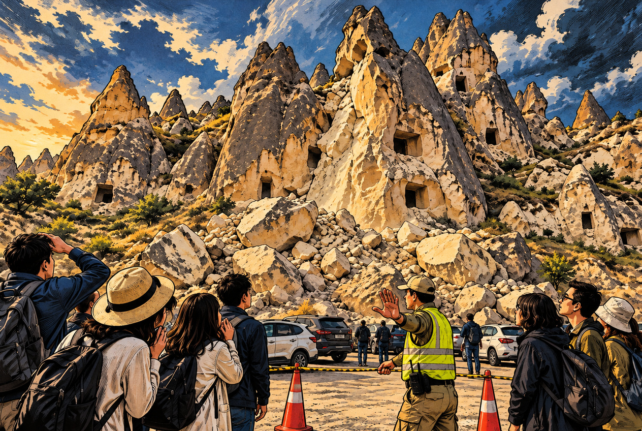
On October 29, 2026, falling rock killed three people and injured five near the entrance to the Göreme Open-Air Museum in Cappadocia, Türkiye. The area is famous for its extraordinary rock formations and the UNESCO-listed landscape of Göreme National Park and the Rock Sites of Cappadocia.
For visitors, Cappadocia is a landscape of fairy chimneys, ancient cave dwellings and hotels carved into rock. But the same natural processes that created those formations are still at work. The scenery is spectacular precisely because the rock has been eroding for thousands of years.
Here is the troubling part: in September 2025, authorities evacuated 19 people before a major rockfall elsewhere in the region. And nearly two decades earlier, another rockfall had already killed three people.
So how does a world-famous heritage destination manage the danger of falling rock? To find out, we compared earlier accidents with university geological reports, UNESCO documentation and Türkiye’s regulations governing Cappadocia.
Three Deaths in 2007, Then 19 People Evacuated Before a 2025 Rockfall
The October 2026 disaster was not the first serious rockfall in Cappadocia. Putting four incidents side by side reveals a more complicated history than a single breaking-news report can show.
| Date | Location | What Happened |
|---|---|---|
| March 6, 2007 | Ürgüp | Falling rock struck an entertainment venue, killing three people and injuring two. |
| September 20, 2025 | Göreme | Part of a fairy-chimney formation collapsed. No casualties were reported. |
| September 21, 2025 | Ürgüp | A major rockfall occurred after 19 residents had been evacuated. No casualties were reported. |
| October 29, 2026 | Göreme | Rockfall near the open-air museum killed three people and injured five. |
In 2007, rock detached from Temenni Hill in Ürgüp and struck an entertainment venue below. Three people died and two were injured. Türkiye’s Chamber of Geological Engineers documented the disaster in a statement issued shortly afterward.
But the most revealing comparison comes from a different site in Ürgüp: Kadıkalesi, where a large section of rock fell on September 21, 2025.
A preliminary geological assessment by Nevşehir Hacı Bektaş Veli University explains what happened before the collapse. Approximately three days earlier, local residents had informed Ürgüp Municipality that cracks in the rock face were widening.
Officials subsequently examined the area. On September 20, 19 residents from three homes were evacuated as a precaution. At approximately 1:58 a.m. the next morning, a major section of the rock face broke away.
There were no casualties.
The university’s report supplies some remarkable measurements. The rock detached from a steep slope approximately 40 metres (131 feet) high. Fragments travelled about 90 metres (295 feet) from their source, stopping near residential buildings. Some individual blocks weighed as much as approximately 35 metric tonnes.
There is another detail worth examining. The site was not completely unprotected before the collapse. Rockfall mitigation measures installed in 2012 included steel mesh and a flexible barrier approximately 3.5 metres (11.5 feet) high.
The barrier stopped some large fragments, although another heavy block damaged part of it.
The danger was not confined to the foot of the cliff. The rocks could travel a considerable distance, and the combination of advance warnings, evacuation and existing protective structures helped prevent casualties.
That does not prove the 2026 tragedy could have been prevented in the same way. These were different locations, and there is no confirmed evidence that the rock involved in the October 2026 disaster showed the same warning signs.
But the 2025 incident demonstrates something important: even when the collapse itself cannot be stopped, keeping people out of the danger zone can make all the difference.
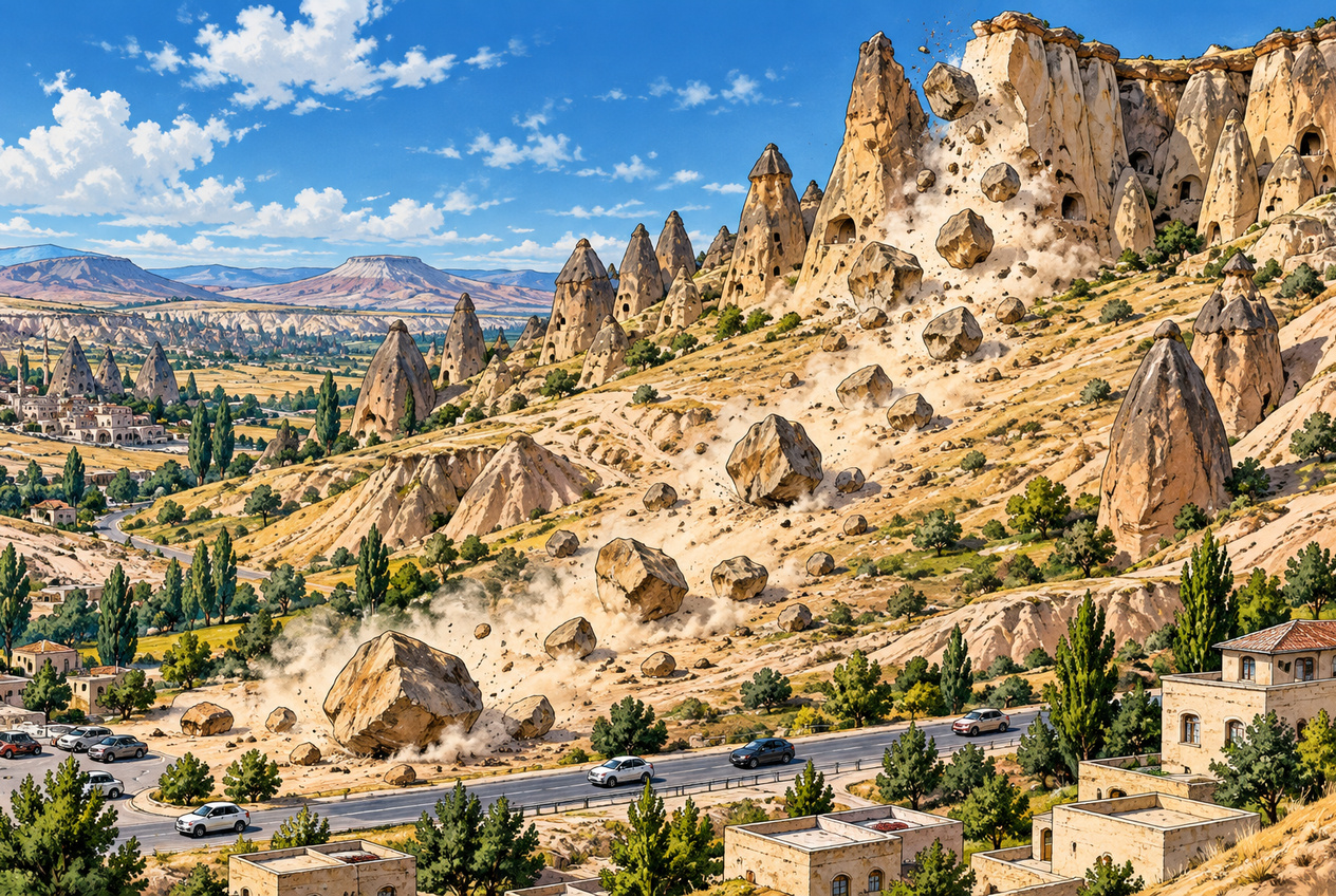
AI-generated schematic illustration. In the September 2025 Kadıkalesi rockfall, fragments travelled approximately 90 metres from a slope about 40 metres high. The terrain, number of boulders, rockfall paths, roads and buildings shown here do not reproduce the actual incident site.
A Rockfall Hazard Map Was Completed in 2020. Disaster Planning Continued in 2026
Perhaps the most unexpected finding is how long geological risk assessment had already been underway.
According to Nevşehir Hacı Bektaş Veli University’s 2020 activity report, a rockfall hazard-mapping project launched in 2016 was completed in early 2020. Its results were approved on February 26, 2020, by AFAD, Türkiye’s Disaster and Emergency Management Authority.
The research used laser surveying and three-dimensional analysis to assess rockfall hazards in eight areas of Cappadocia.
This is not evidence that the particular rock involved in the October 2026 tragedy had been identified as dangerous. The available documentation does not establish whether that location was among the eight study areas.
Nevertheless, the region’s rockfall problem was hardly a newly discovered phenomenon.
On December 16, 2025, the Cappadocia Area Presidency, the regional body responsible for heritage-area management, publicly announced that strengthening and restoration work had begun on a fairy-chimney formation in Göreme considered at risk of collapse.
Then came another revealing date.
On October 7, 2026, Nevşehir Hacı Bektaş Veli University published an account of a workshop concerning the province’s 2027–2031 disaster risk reduction plan. The discussions included the adverse effects of rockfalls on residential areas and tourism.
Just 22 days after that university report was published, three people died in the Göreme rockfall.
The publication date should not be mistaken for a confirmed date of the workshop itself. Nor is there evidence that the workshop specifically examined the rock involved in the fatal accident.
What the records do establish is that rockfall risk was already the subject of academic research, official planning and physical intervention in Cappadocia well before October 29.
UNESCO Protects the Heritage. But Who Protects the Visitors?
Reading UNESCO’s official description of Cappadocia reveals an uncomfortable distinction.
Göreme National Park and the Rock Sites of Cappadocia were inscribed on the World Heritage List in 1985. UNESCO recognises the landscape’s exceptional natural formations and its extraordinary rock-cut cultural heritage.
But UNESCO also identifies natural erosion and the pressures of tourism as threats to the site’s heritage values. In other words, the vulnerability of Cappadocia’s rock formations is not some obscure problem overlooked by the World Heritage documentation.
The rocks and the historic structures carved into them are subject to the very geological processes that made the landscape famous.
There is, however, an essential distinction. UNESCO’s assessment concerns the protection of cultural and natural heritage. It is not a safety certificate for every cliff, footpath, road or parking area.
So who is responsible for safety on the ground?
Türkiye has a dedicated Cappadocia Area Presidency. Article 7 of a regulation issued in 2021 assigns its planning and implementation unit duties involving the conservation, repair, restoration and improvement of protected assets, including fairy chimneys. It also provides for necessary safety measures to be taken or arranged.
That makes it misleading to suggest that heritage protection somehow prevents all safety intervention.
For this investigation, it helps to separate the practical tasks into three categories. These are our editorial categories, not three formal legal classifications:
- Conservation: Inspecting vulnerable formations and carrying out appropriate stabilisation or repairs.
- Access restrictions: Identifying hazardous areas and limiting public use where necessary.
- Evacuation: Temporarily moving people away when conditions or warning signs indicate an immediate risk.
These responsibilities overlap, but they are not necessarily administered by a single authority. The body responsible for conserving a rock formation may not be the same organisation that manages a road, parking area or tourist facility below it.
A hazard assessment can identify a problem. Protecting visitors requires that knowledge to be translated into decisions about where people may safely go.
Whether that process failed at the October 2026 accident site remains an unanswered question, not an established finding.
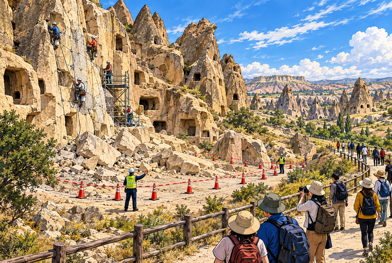
AI-generated explanatory illustration showing the separate roles of rock conservation, restricted hazard zones and visitor routes. It does not reproduce an actual restoration project or the access-control arrangements at the October 2026 accident site.
Could the Fatal Rockfall Have Been Prevented?
Following the October 29 disaster, Nevşehir Governor Hüseyin Kök pointed to heavy rainfall and ground movement as possible contributing factors. Prosecutors began investigating the incident, and the governor also announced administrative scrutiny.
At the time of writing, several critical questions remain unresolved.
Had the rock shown visible cracks or other signs of instability? Had this particular location been designated as hazardous? Had a site-specific risk assessment been conducted? And was restricting access considered before the collapse?
Without answers, it would be irresponsible to conclude that the authorities knowingly ignored a specific, documented danger.
Yet the previous incidents make the questions more difficult to dismiss.
In 2025, residents reported widening cracks, officials evacuated 19 people, and an existing barrier stopped some falling debris. In 2026, three people died at a different site.
These outcomes are not a controlled comparison. Different rocks, weather conditions, warning signs and exposure levels may all have mattered.
Still, they establish the practical issue at the centre of this investigation: when falling rock is a known hazard, how does information about that hazard become a decision to restrict access?
The investigation needs to establish not only why the rock fell, but whether its danger could reasonably have been identified in advance and which organisation had the responsibility and authority to act.
Editor’s Note
To me, the surprising part is not that a rock formation in Cappadocia collapsed. These extraordinary shapes exist because the landscape has been worn away over time. Expecting the rock to remain unchanged forever would be stranger than the collapse itself.
What bothers me is the history surrounding it.
Three people died in 2007. Nineteen people were evacuated before a major rockfall in 2025. There were hazard maps, protective barriers, restoration projects and disaster-planning discussions. Then, in 2026, another three people died.
That is a lot of accumulated experience to have on the books.
For travellers, a UNESCO World Heritage designation can feel reassuring. But a World Heritage badge is not a safety certificate. It tells us why a place deserves protection, not whether every place a visitor can stand is safe from falling rock.
Preserving these extraordinary formations matters. So does making sure the people who come to see them are not placed unnecessarily in their path.
I would rather hear exactly what was known about the rock, who was responsible for the surrounding area and how access decisions were made than be given another vague explanation about the unpredictability of nature.
That, ultimately, is the part of this disaster I want the investigation to explain.
References
- Anadolu Agency (October 29, 2026). Report on the Göreme rockfall that killed three people and injured five. In Turkish.
- UNESCO World Heritage Centre. “Göreme National Park and the Rock Sites of Cappadocia.” Official World Heritage property description, including conservation and management concerns.
- Union of Chambers of Turkish Engineers and Architects (TMMOB), Chamber of Geological Engineers (March 2007). Statement on the fatal Ürgüp rockfall. In Turkish.
- Anadolu Agency (September 20, 2025). Report on the partial collapse of a fairy chimney in Göreme. In Turkish.
- A Haber / Anadolu Agency (September 21, 2025). Report on the Kadıkalesi rockfall and the precautionary evacuation of 19 residents. In Turkish.
- Nevşehir Hacı Bektaş Veli University, Department of Geological Engineering (2025). Announcement of the preliminary assessment of the September 21 Kadıkalesi rockfall. In Turkish.
- Dinçer, İ., Akın, M., Orhan, A. and Uslu, N. (2025). “Kadıkalesi (Nevşehir–Ürgüp): Preliminary Assessment Report on the September 21, 2025 Rockfall.” Nevşehir Hacı Bektaş Veli University. PDF in Turkish; documents the advance warning, protective barriers, approximately 35-tonne blocks and 90-metre travel distance.
- Nevşehir Hacı Bektaş Veli University, Cappadocia Geological Heritage and Rock-Hewn Structures Research Centre. “2020 Activity Report.” Rockfall hazard-mapping research, p. 22. PDF in Turkish.
- Cappadocia Area Presidency (December 16, 2025). Official announcement of strengthening and restoration work on an at-risk fairy chimney in Göreme. In Turkish.
- Nevşehir Hacı Bektaş Veli University (October 7, 2026). Report on the provincial disaster risk reduction planning workshop for 2027–2031. In Turkish.
- Republic of Türkiye, Official Gazette No. 31496 (May 30, 2021). Regulation on the Working Procedures and Principles of the Service Units of the Cappadocia Area Presidency, Article 7. In Turkish.